


Overview
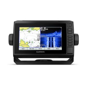
12″ Touchscreen Chartplotter/Sonar Combo
- 1 kW single-channel CHIRP sonar provides crystal-clear images with remarkable target separation and definition
- ClearVü and SideVü scanning sonars deliver nearly photographic images of what is below, around and to the sides of your boat
- Fully network capable to build your marine system
- Network sharing allows you to share data among all compatible units connected to the network
- Supports Panoptix™ all-seeing sonar
- Add free all-in-one ActiveCaptain™ app to manage your marine experience from nearly anywhere
- Compatible with optional BlueChart® g2 Vision® HD charts for Auto Guidance1 and more
GPSMAP 1222xsv Touch is the ideal choice for the coastal fisherman who wants to step up to a big, bright 12″ touchscreen combo. It includes built-in 1 kW single-channel CHIRP plus ClearVü and SideVü scanning sonars, and it’s compatible with Panoptix all-seeing sonar. It features full networking capabilities to build your marine system with radar, autopilots, sonar modules and sensors. It also supports FLIR cameras, GRID™ keypad, FUSION-Link™ audio system, VIRB® camera streaming and more. Network sharing allows you to share data among all compatible units connected to the network. Plus, it has built-in Wi-Fi® to support ActiveCaptain app. The touchscreen combo comes preloaded with worldwide basemap.
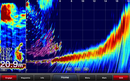
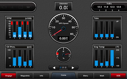
Built-in Sonar Capabilities
Access some amazing sonar capabilities — all you add are transducers. GPSMAP 1222xsv Touch comes with built-in Garmin 1 kW CHIRP sonar and CHIRP ClearVü and SideVü scanning sonars. It even supports Panoptix all-seeing sonar, premium Garmin sonar modules and a wide range of transducers (sold separately).
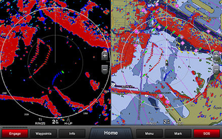
Build Your Marine System
GPSMAP 1222xsv Touch is fully networked using Garmin Marine Network, NMEA 2000®/NMEA 0183, J1939 and built in ANT® connectivity, so you can build your marine system with radar, autopilot, sonar modules, instruments, sensors, FLIR cameras, FUSION-Link, VIRB camera streaming and more. Network sharing allows you to share data among all compatible units connected to the network.
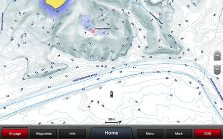
Upgrade with Our Best Maps on the Water
BlueChart g3 coastal charts let you experience unparalleled coverage and brilliant detail when you’re on the water. They provide industry-leading coverage and clarity with integrated Garmin and Navionics® content. The charts also use your desired depth and overhead clearance to easily calculate suggested routes with Auto Guidance1 technology. Up to 1 ft contours featured on the fishing charts provide improved detail and a more accurate depiction of the bottom structure. And easy-to-use features such as Depth Range Shading and Shallow Water Shading let you view your target depth and avoid running aground.
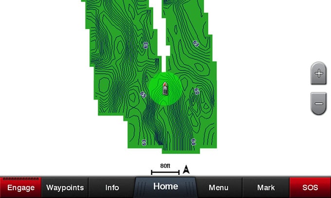
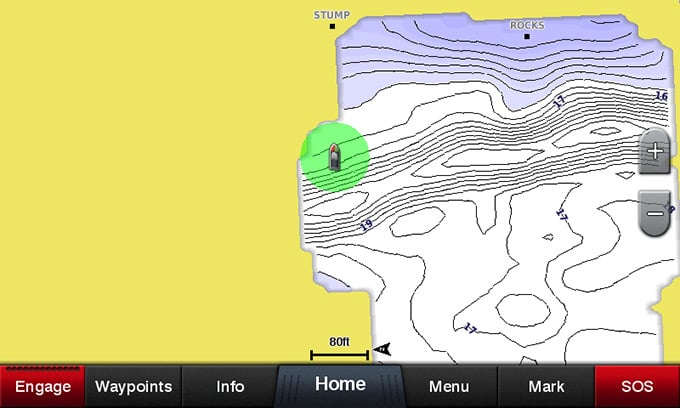
Built-in Quickdraw Contours to Create Your Own HD Maps
Instantly create personalised HD fishing maps onscreen with 1-foot contours. Tailor them to fit your needs. These are your maps — you own them. Keep the data to yourself, or share it with the Quickdraw community.
The Ultimate Connected Boating App
Built in Wi-Fi gives you access to the free all-in-one ActiveCaptain app, so you can manage your marine experience from nearly anywhere. It creates a simple yet powerful connection between your compatible mobile device and your Garmin chartplotter, charts, maps and the boating community. Wherever you are, you’ll have unlimited access to your cartography, the ability to purchase new maps and charts and access to the Garmin Quickdraw™ Contours community. Stay connected with smart notifications on your chartplotter screen. You can also plan a trip or prefish a lake, and ActiveCaptain will automatically sync with your chartplotter. Even get notifications for software updates, and decide when to download them on your device.
Built-in SailAssist Features
To help you gain a wind-maximising competitive edge, your chartplotter features a pre-race guidance page. It shows your virtual starting line along with data fields showing laylines, time to burn before the start and a race timer that can be synchronised across all your networked Garmin GPS products. In addition, other supported sailing features include an enhanced wind rose, heading and course-over-ground lines, set and drift, true and apparent wind data and more.
Heading and Position Refreshed 10 Times Per Second
The fast, responsive 10 Hz GPS and GLONASS receiver refreshes your position and heading 10 times each second to make your movement on the screen more fluid. Now, it’s quick and easy to drop up to 5,000 accurate waypoints and find your way back to them.
1 Auto Guidance is for planning purposes only and does not replace safe navigation operations
Wi-Fi® is a registered trademark of the Wi-Fi Alliance.
![]()
![]()
![]()
![]()
![]()